 |
HELSINKI UNIVERSITY OF TECHNOLOGY |
| LABORATORY OF COMPUTER AND INFORMATION SCIENCE | |
| NEURAL NETWORKS RESEARCH CENTRE |
Cloud Classification in Satellite Images (1991-1995)
Jukka Iivarinen,
Sigbrit Näsman,
Kimmo Valkealahti,
Ari Visa,
Markus Peura, Panu Somervuo, and Jaakko Särelä
IntroductionThe data received from weather satellites are used in weather forecasting and long-term prediction by the Finnish Meteorological Institute. The main motivation for the present study was the need for automatic methods to interpretate satellite images. This has been studied in Laboratory of Computer and Information Science in Helsinki University of Technology since 1991. The main interest has been the classification of clouds from satellite images. As a result a cloud classifier is implemented. The classifier is a multispectral, vector-based classifier. The classification of a satellite image is done in two phases. In the first phase clouds are separated from surface and in the second phase the cloudy regions are classified into ten cloud types. The classifier is fully automatic, and it can be adapted to changing situations with new examples. |
 |
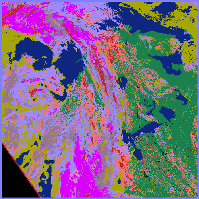
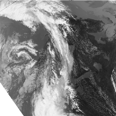
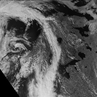
Images |
|
|
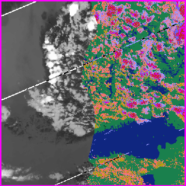
Southern Finland 20th July, 1993, at 12:45 p.m. (GMT) |
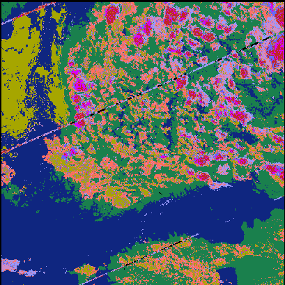
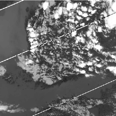
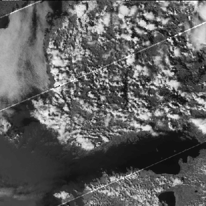
Scandinavia 11th July, 1993, at 12:54 p.m. (GMT) |
Papers
Here are the abstracts of published papers. For some papers also a postscript version is available for download.Journal Papers
Conference Papers
- Cloud Detection Based on Texture Segmentation by Neural Network Methods (IJCNN'91)
- Self-Organizing Feature Maps in Texture Classification and Segmentation (ICANN'92)
- Operational Cloud Classifier Based On the Topological Feature Map (ICANN'93)
- Experiences from Operational Cloud Classifier Based on Self-Organising Map (SPIE'94)
- Feature Selection with Self-Organizing Feature Map (ICANN'94)
- Verification of a Multispectral Cloud Classifier (SCIA'95)
- Neural Network Based Cloud Classifier (ICANN'95)
Technical Reports
- An Operational Cloud Classifier Based On A Self-Organized Feature Map (Report A19)
- Development of a Cloud Classifier (Report A25)
http://www.cis.hut.fi/research/IA/cloud_classifier/index.shtml
jucca@mail.cis.hut.fi
Thursday, 20-Apr-2000 11:36:46 EEST